

THE ROAD LESS TRAVELLED
I realised the true meaning of this statement while traveling through the roads of Ladakh. The experience of this journey has been unforgettable. In my opinion, it is worth sharing with other enthusiasts who wish to follow the ‘Road Less Travelled’
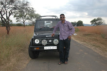
Having earned my coveted dolphin, I was looking forward to some adventure in the leave that was to follow. I and my friend Anant, an avid adventurer himself hit the road in my car. We had decided to move to
It was late evening once we reached Manali ,the roadhead for the trans-Himalayan highway for the near-legendary journey to Ladakh's capital, Leh and to Spiti valley. It was an awesome experience to be in the valley after 11 years. We quickly moved through the streets of Manali, in order to equip ourselves for the trip as we were grossly under equipped for the weather and the terrain that we were going to face. We decided to spend some time with locals and the drivers to have the better insight of the route . After 15 minutes of the mingling around with them we knew that we had to change our objective as the Kunjum La was not feasible because of the rains. The decision was then taken to persue the drive towards Kelong and explore the roads as far as we could. We bid good bye to manali at 0830 hrs on 26th and started towards our first way point – Zero Point. On our way, as the signboard read the last petrol pump of the valley of gods we topped up our car and then we perused the journey ahead. As we took the snaking turns on that beautiful road, I was reminded of our childhood I had spend in these hills.
It was a lovely sight to see the clouds playing a childish note in the valley that is called the valley of gods. We took small breaks for capturing the magnificient views that nature offered. Finally just before zero point we took a halt to see Beas Kund that is considered to be the origin of river
The descent from Rohtang to the floor of the
All buses stop at Darcha, we reached here at about 1700 hrs. A hot bowl of Tibetan thupka from a roadside dhaba was refreshing . We also cherished dimsums( momos ) and then we moved on. From Darcha, the road climbs steadily along the mountain side of wine-red and pale-green scree to Zingzing Bar. As you move from this desolate land, you see a refreshing Suraj tal next to the road which and then the steep curly climb to Baralacha La, which will blow your mind. The "twelve-horned" pass forms the head of three valleys, the Bhaga, the Chandra, and the Yunan. Very rarely you will find vehicles plying at night crossing Baralacha La and the reason became quite evident while negotiating towards the pass. We finally got down at 2030 hrs to step on the pass only to feel the chilling wind piercing through us. The decent from the pass was through the bumpy road and tyring till we reached the plains next to Bagha river at the bottom of a high, straight peak. Sarchu the last village of himachaL; which is mearely few tents and dhabas. We pitched out tent and snuggled in our sleeping bags. The layers of clothes were not able to protect us from the chilling cold that kept troubling us throughout the night. We were really ill equipped for such terrain.
At 0730 hrs We headed for Lachlang La (5,059m) from Sarchu, the second highest pass on the highway, before descending to Pang at 4,500m. The view was something that could only be imagined, the transision of the colour of the peaks to golden as the sunrays kissed and then the gold would spread along the valley. The series of hairpin bends take you to the other side of mountain and now there is no civilization but only solitude. 3 km from Pang is the extraordinary Moray Plains (4,800m), a 45-kilometre-long plateau encircled by rolling hills and brilliant white Himalayan peaks. Such a awesome sight and I had my worried as the road was full of sand over the plateau and few vehicles and already got stranded there like bolero and sumo. There was only one question in our mind at that time will we be able to cross the sea of sand that lie ahead like an enemys ambush. We had no choice but to pass as retreat was out of question. After talking to few drivers the plan was to detour away from the road and drive on not loosing the reference of the road as we were already low on fuel any mistake would leave us stranded and time is the luxury that we were devoid off. It was like a eight lane highway as we drove over the pleateu with the snow clad mountains on the sides and the speedometer showing 90kmph. The joy was shortlived as we saw a truck struggling with sand. We were now driving on the dried up lake and somehow we were able to pull through that beast of sand and make it back to road. It was indeed one of the most happiest moment of my live we had just conqured one of the biggest hurdle.
The road starts its ascent from Dibring Camp to Tanglang La at a head-spinning 5,328m. This is the second highest pass in the world and by the time you reach there, your nose might well start bleeding slightly. This is a symptom of altitude-sickness. The road was all bumpy with big holes and then the ascend took tool and sometimes the car almost refused to move up. The view at the top was breath taking and ofcoures so chilling that our soles too froze, but the fact that we were now on the second heighest motorable road of the world kept us warm. At this juncture my heart saluted our soldiers fighting in such harsh condition where survival itself is an art and to the BRO ( Border Road Organisation ) that makes and maintains the road in such conditions where the nature humilates you and pushes you to limits.The Karakoram range of the Himalayas, visible from here signals that you are approaching Ladakh. This road goes along our age-old
Upsi is the gateway to leh the project for constructing and maintaining the highway, undertaken by the Indian army concludes. Considering the rugged terrain of the mighty
n the way from Upshi to Leh (40kms) there are high peaks crowned with village houses and gompas. Gompas are Buddhist monasteries, ranging from solid stone structures to fairly large temples. The signboard welcome to leh was such an relief and the sight of civilization was like a sight of an oasis in the middle of a desert. The overnight stay in leh was in the transit camp and we enjoyed the full hospitability of the army. We were woken up in the morning with the roar of the aircraft that was an awesome sight as the aircraft made a final approach for an airfield surrounded by the mountains. We were to bid good bye to leh that afternoon and move forward for another journey which was a rush back to yol camp through kargil, drass srinagar jammu pathankot and finally home. The memory still lingers and one requires one month to spend in to see and explore the place. Wish to be there again……….

2 comments:
“To dream anything that you want to dream. That's the beauty of the human mind. To do anything that you want to do. That is the strength of the human will. To trust yourself to test your limits. That is the courage to succeed.”
such an inspiring thoughts
will and courage big words I need to go a long way
Post a Comment